

UI / UX Redesigning - Ontario Trails Map

O Problema
O sistema anterior do Ontario Trails Map enfrentava desafios técnicos e de usabilidade que comprometiam a experiência do usuário:
Tecnologia desatualizada: Impactava diretamente a velocidade do sistema e sua principal função — ajudar os usuários a encontrar trilhas.
Dificuldades de navegação: Os usuários tinham dificuldade para encontrar trilhas de forma clara e intuitiva.
Integração limitada de eventos: O sistema dificultava a participação dos usuários em eventos comunitários e turísticos.
Barreiras ao turismo: Reduzia o potencial de atrair visitantes, especialmente considerando a relevância das trilhas da região como destino internacional.
Meu Papel
Como Product Designer, estive envolvido em todas as etapas-chave do redesign, incluindo::
Investigação e análise inicial: Estudo aprofundado do site antigo para identificar problemas estruturais e funcionais.
Mapeamento visual do sistema: Documentação da arquitetura existente para identificar pontos críticos de melhoria.
Compreensão do público-alvo: Análises para definição de personas e entendimento do comportamento e necessidades de turistas e entusiastas locais de trilhas.
PROCESSOS
Pesquisa e Descoberta
Realização de entrevistas por videochamada com usuários locais e stakeholders do projeto.
Análise de benchmarks de sistemas similares em outros destinos turísticos, com o app AllTrails como principal referência e concorrente.
Revisão de métricas de uso do sistema antigo.
Teste de Usabilidade
Testes realizados com 6 usuários reais, incluindo turistas e moradores locais.
Iterações na solução com base nos feedbacks coletados.
Análise de Dados
Identificação de padrões de comportamento dos usuários.
Priorização de problemas críticos com base em dados qualitativos e quantitativos.
Handoff e Monitoramento
Entrega de documentação detalhada para o time de desenvolvimento, incluindo diretrizes de design.
Definição de KPIs para acompanhamento dos resultados após o lançamento.
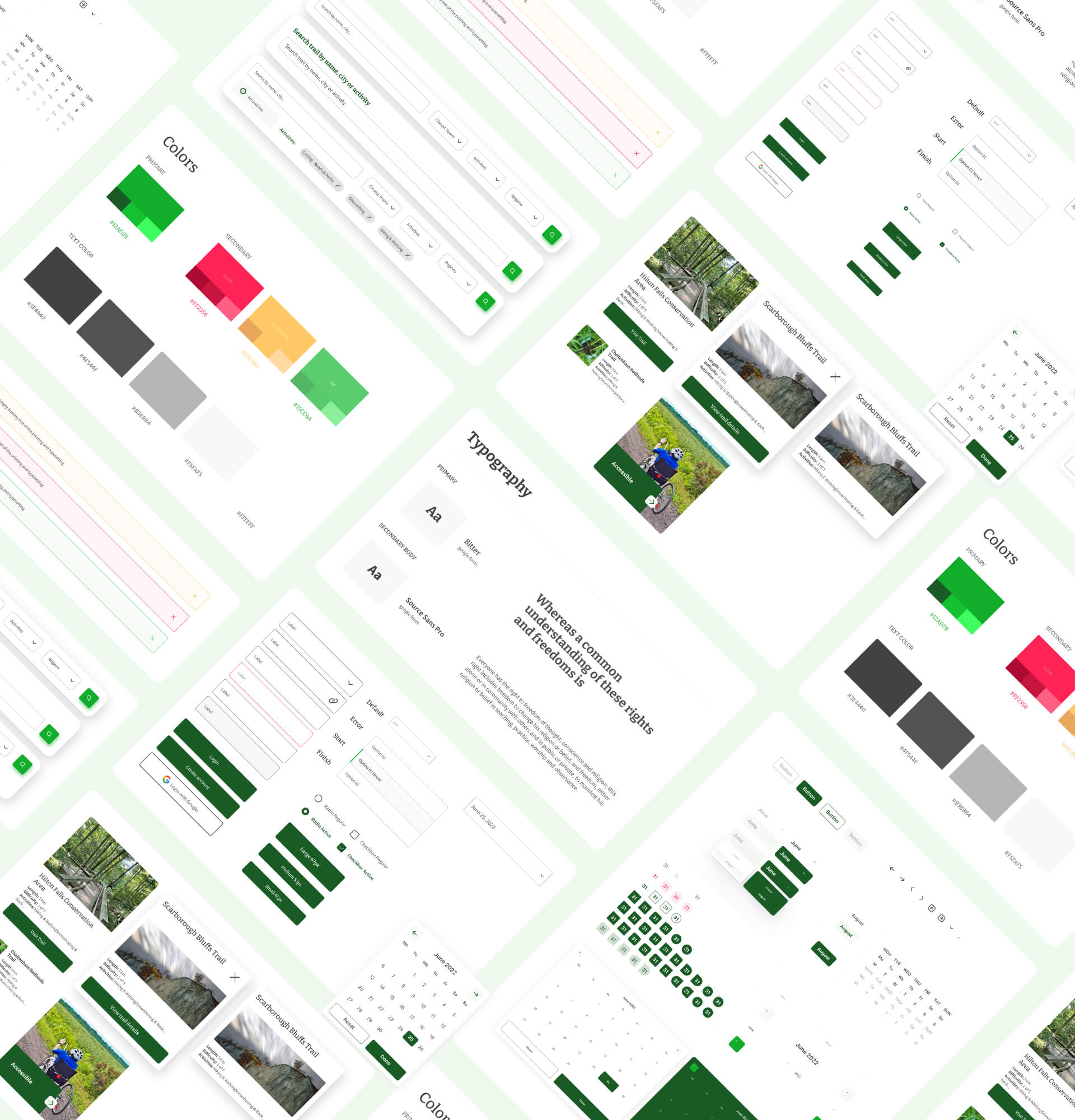
Prototipação
Criação de wireframes de baixa fidelidade no Figma para testar fluxos de navegação.
Evolução para protótipos de alta fidelidade no Figma, simulando a experiência final do usuário.
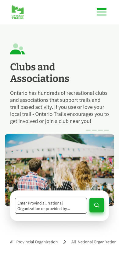
Solução
O redesign do Ontario Trails Map resultou em:
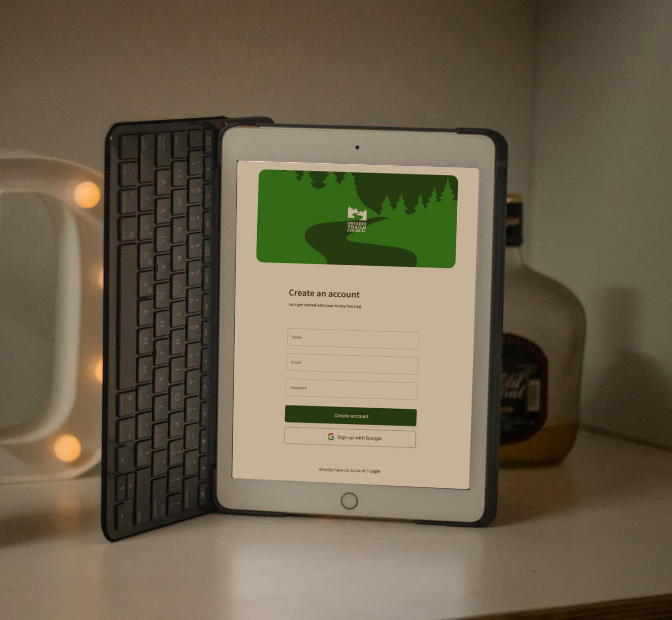
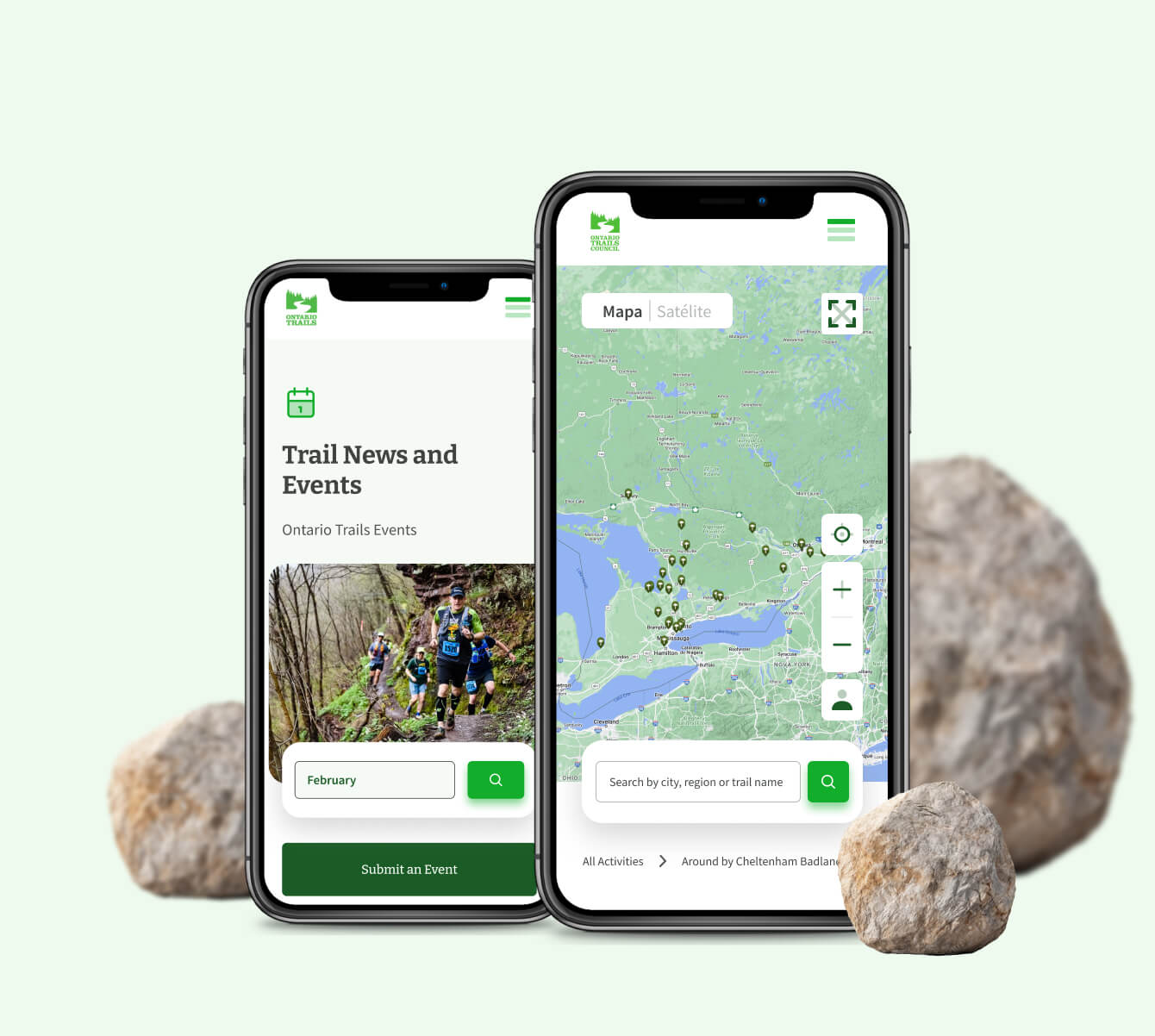
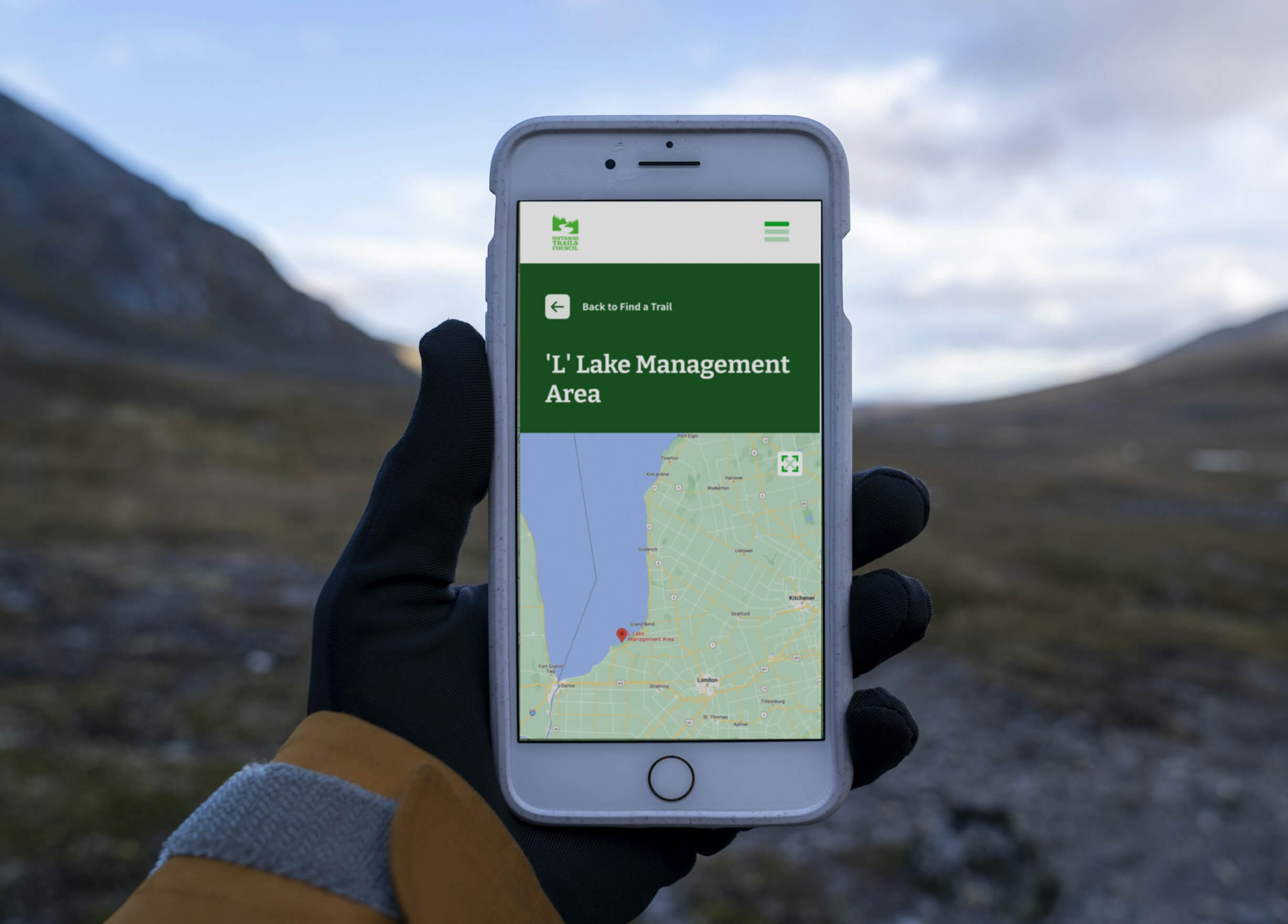
Plataforma moderna e responsiva: Totalmente compatível com desktop, tablet e dispositivos móveis.
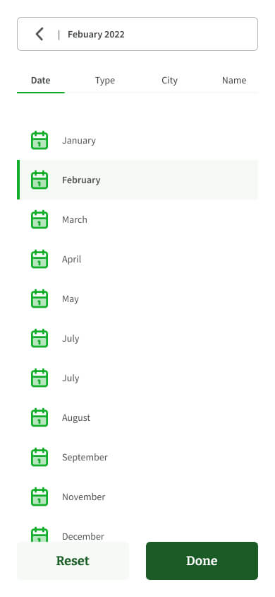
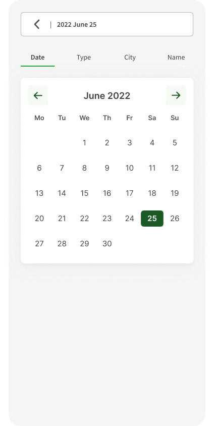
Mapa interativo otimizado: Navegação simplificada e busca por trilhas com filtros avançados.
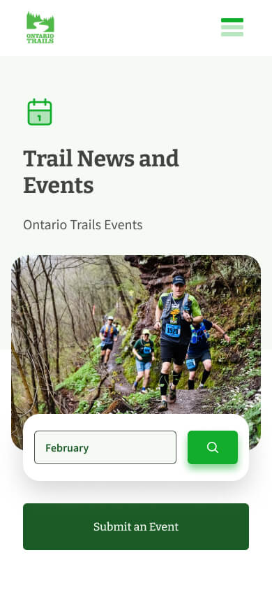
Integração com eventos locais: Usuários podem explorar e participar de atividades diretamente pela plataforma.
Experiência amigável: Interface simples e intuitiva, incentivando o turismo na região.


Resultados após 30 dias de monitoramento:
15%
Redução da taxa de rejeição: Queda de 15%, impulsionada por melhorias de usabilidade e velocidade de carregamento.
20%
Aumento na duração média da sessão: Crescimento de 20%, refletindo maior engajamento com o mapa interativo e funcionalidades de eventos.
10%
Crescimento no tráfego orgânico: Aumento de 10%, apoiado pelo design responsivo, melhorias de experiência e otimizações de SEO.
Principais Aprendizados
Em todo projeto que participo, dedicar tempo para compreender a rotina, a lógica e a perspectiva de quem está do outro lado da tela — junto com suas dores — torna o trabalho muito mais significativo.
Neste projeto, consegui desenvolver uma empatia profunda com usuários que passam 8 horas em trilhas íngremes, com inclinações superiores a 45°, percorrendo 20 a 30 km sem acesso à internet.
Isso evidenciou a necessidade crítica de um mapa confiável em mãos e, mais importante ainda, de uma plataforma onde fosse possível encontrar todas as informações essenciais para se preparar adequadamente para a trilha.
Esses aprendizados foram refletidos tanto na experiência do usuário quanto no design do novo Ontario Trails Map, garantindo que ele realmente atendesse seu público da melhor forma possível.
Mais


🧑
Monday
August 5, 2024
Hi, João
You still have 7 visits left for today!
Goal
14
visits
Completed
6
visits
Visits
+15 EXP
8 clients on the route still need to be visited
100
%
Details
Complete
Ver trabalho completo

